|
Help | | | News | | | Credits | | | Search | | | Guestbook | | | Forum | | | Shop | | | Contact Us | | | Welcome |
Westwood Works 1903-2003 |
|||||||||||||||||
![]() In
the beginning there were cabbages! This is the site of Westwood Works before
any building work was begun. Allotments as far as the eye could see. But even
before that:
In
the beginning there were cabbages! This is the site of Westwood Works before
any building work was begun. Allotments as far as the eye could see. But even
before that:
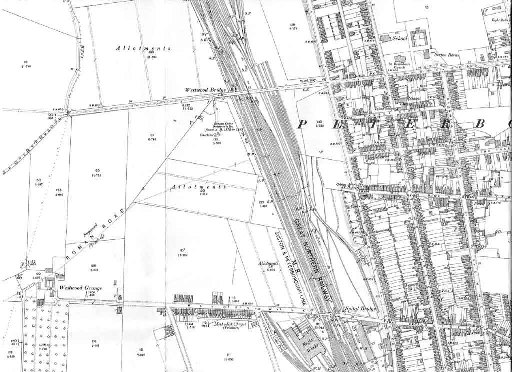
The 1901 OS map indicates only allotments to the west of the bridge between the railway and the line of what is now Gresley Way, with nothing but open farmland between Westwood Bridge and Mayors Walk, which at that time terminated at Westwood Grange. The road to the west of Westwood Bridge was known simply as Westfield until after WW1.
The ten-acre site purchased by Mr. F.C. Ihlee of Werner, Pfleiderer & Perkins (see also History of Werner, Pfleiderer & Perkins - F.C. Ihlee), for £3,040 from the Church Commissioners on December 22nd 1903 is shown as allotments and some of the land around the factory site was still being used for this purpose up until the time that the factory was demolished in 2003 and work on HMP Peterborough commenced.
Aublet Harry purchased the land immediately opposite Westwood Works in 1904 and moved their business from London into their new factory buildings in 1905, one year after WP&P.
|
1901: Map of the Westwood Area |
All content © the Website Authors unless stated otherwise.